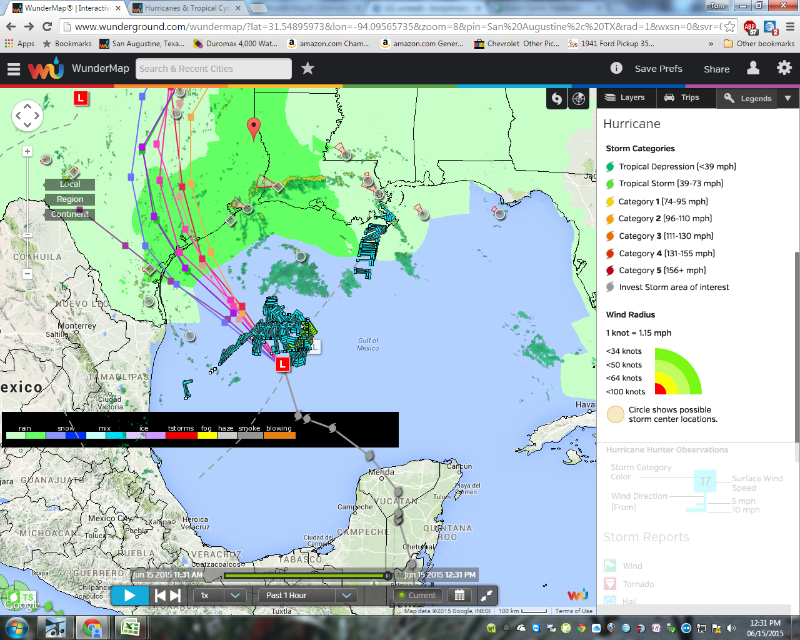
Invest 91L is expected to become Tropical Storm "BILL" before it makes landfall. It is becoming more organized and beginning to spin and generate more T-storms that are an indication of strengthening. The winds are consistently near the 40 MPH TS status. Landfall tonight or early tomorrow morning.
The jet stream currently dips down and flows North over New Mexico and will funnel the rainfall all the way to the East Coast. There is a HIGH pressure system sitting over Miss, Ala, Georgia that is holding this weather from moving East for at least the next 4-5 days as there is no LOW or cold front to steer it particularly this time of year when those high pressure domes settle in.. The outer bands around the High to our East is where the T-storms and rain will continue to form. Major flooding is anticipated from the Gulf Coast up into the Central Plains to Chicago as this trains over already saturated ground. The moisture in the ground will allow the T-storms to continue to fire up even after the storm gets over land due to the available moisture.
The outer bands on the North East side are already being sent outward and are rapidly reaching into the Louisiana and Texas Coastal Land areas. The midpoint of storm will be along I-35 corridor. If the current trend continues, the East side of the storm will see the heaviest rainfall....a significant amount will fall in Deep East Texas and our area could see 2-5 inches through Thursday. Winds of 30+ miles per hour should be expected, especially in the Primary T-storm locals. Hopefully the storm will move to the North and out of Texas faster than the current speed(NNW at 15 MPH). Location 200+ miles SSW of Corpus. If the track is more along the West of I 35, then all the flooding and heaviest activity will focus on the Trinity river, Texoma, red river, and already flooded OKLA and North.
.jpg)

