Just for the folks North of IH 20 & not expected to accumulate even there.
I just received an email from the NWS and will gain more detail tomorrow during the Weather Briefing. Until then, here is the latest on our continuing rain and a teaser on the snow.
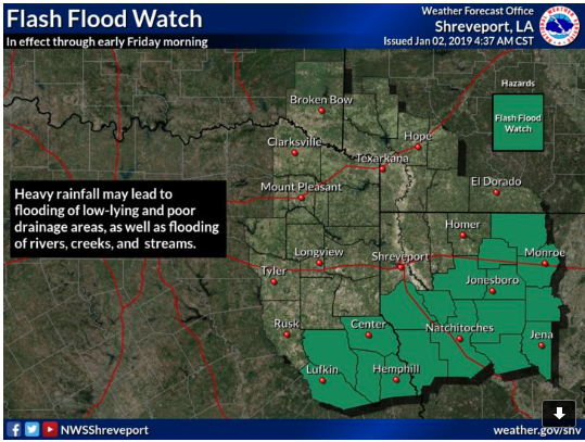
*A Flash Flood Watch remains in effect through late Thursday night for portions of Louisiana and east Texas*
- Weather Timing and Overview:
An upper level low pressure system will approach from the west on Thursday and cross the area Thursday night into Friday. Widespread rainfall will be heavy at times and continue across the region tonight and through Thursday night, especially for areas in the Flash Flood Watch. On Thursday night into Friday morning, a mix of rain, snow, and sleet will be possible along and north of the I-20 corridor as the upper low moves over the area.
Four State Impacts:
Impacts: Heavy rainfall may lead to flooding of low-lying and poor drainage areas, as well as flooding of rivers, creeks, and streams. No impacts anticipated from snow/ice at this time as surface temperatures should mostly be above freezing, we will be monitoring this closely over the next day.
Rainfall Accumulation: 3-5 inches possible in the watch area with isolated higher amounts. 1-3 inches possible elsewhere.
Snow/Ice Accumulation: Little or no snow/ice accumulation along and north of I-20 Thursday night into early Friday morning.
.jpg)


 Click For Louisiana
