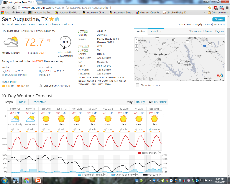
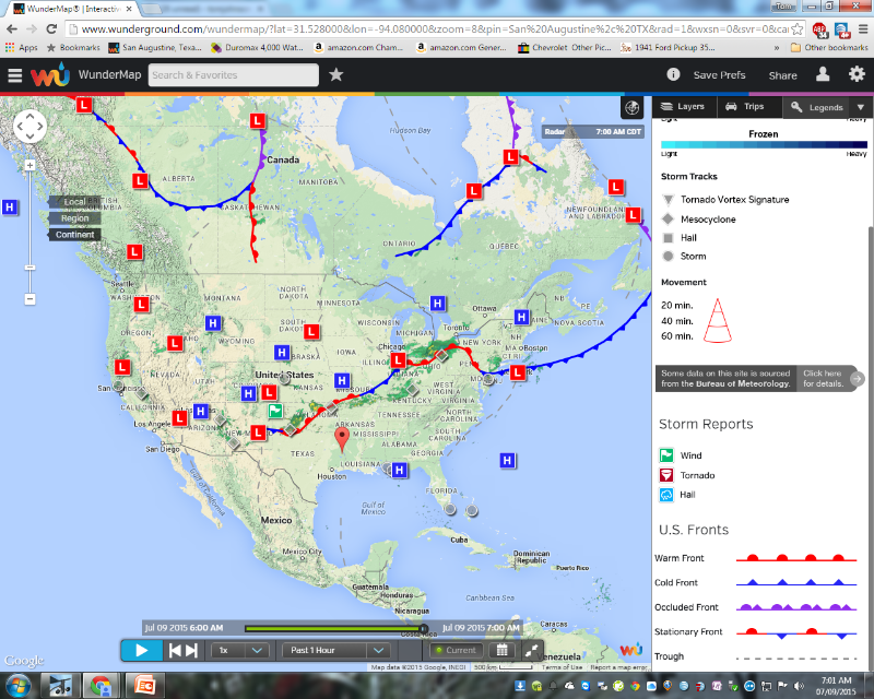
You can see from the first graphic below that the HIGH pressure has established a strong presence over the Southern part of the US. The frontal LOW has continued to sit over the North West portion of the state and is slowly moving back to the North. That movement will allow our temperatures to push their way to blazingly hot SUN with no clouds by this weekend while closing the gap on the 100 degree mark. Humidity will remain High and the Temperature humidity Index will hover in the 110 degree range. Our rain chances will shift North of our area with only isolated sea breeze type convection South of I-20 through Friday afternoon. As the upper ridge becomes centered over Texas and gradually increases, along with increasing ground dryness, afternoon highs in the upper 90s to low 100s is expected and will become more prevalent with no probability of precipitation through the weekend and into late next week.
HEAT RELATED ISSUES WILL BE SEEN DURING THIS PERIOD.
The graphic below is a visual of the forecast I described in the start of this message. Please use caution in your outdoor activities. Take frequent breaks. STAY HYDRATED!
Tom JohnsonKTXSANAU6
.jpg)


 Click For Louisiana
